


Sea level data started to be collected in Genoa in 1884. Since 1954 sea level measurements at the Old Harbour have been used to calculate the mean sea level (averaging out tide measurements over a period of time), which is used as a standard to calculate heights and elevations throughout Italy.
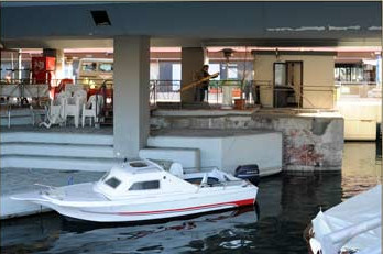
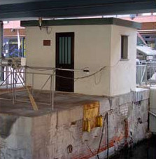
Obviously, the equipment used to record tides improved greatly, since 1884. In 1910 the tide gauge was moved to its current location, at Ponte Morosini.
The IIM tide gauge at Ponte Morosini consists of a float operating in a stilling well, to dampen oscillations due to waves, which would affect the results.
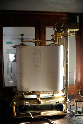
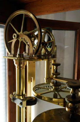
In the first tide gauge used in the port of Genoa, the float was connected to a pen, recording any variations of the sea level on a roll of paper which turned tanks to a spring mechanism similar to that of a clock. In the last 20 years, more modern equipment has been introduced, using pressure and radar sensors.
Float oscillations, as values of the distance between the water surface and the device, which is fixed to a granite structure to keep it as stable as possible, are sent to a decoder and then to the IIM offices, via a GSM modem. A dedicated software allows for real time displaying of tide graphs and pressure and temperature values detected through the relevant sensors.
GALLERY