Geomorphology in the Digital Age
ORGANIZED BY
Anselme Muzirafuti
University of Messina
Stefania Lanza
University of Messina
ABSTRACT
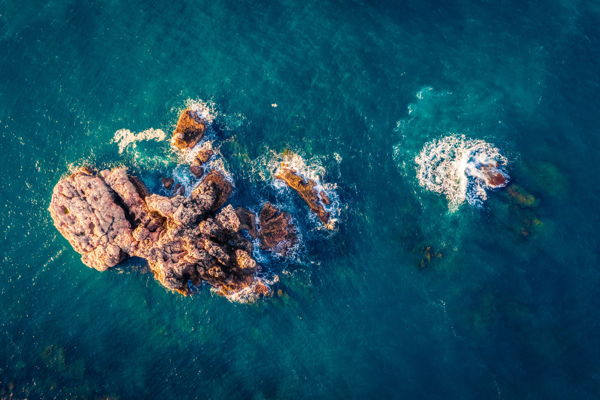
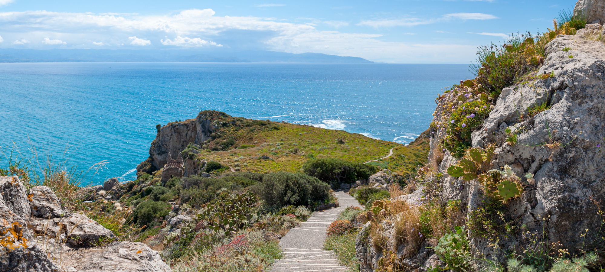
The digital age, which is the time when a large amount of information is available, has revolutionized the way Geomorphology studies are conducted. These studies were traditionally perfomed through field observations or physical experiments to study the origin, devolvement and composition of landforms. However, freely available satellite images make it possible to remotely access physical landscape changes while high-speed internet enables access to online digital maps. The increasing performance of computer systems and sensors has also advanced topographic modelling and geochronological techniques, making it possible to visualize, determine the ages of and make measurements of different landforms. This not only enables scientific studies but also humanitarian activities such as rescue mission planning in mountainous and hard-to-reach environments. With increasing changes in the climate system and growing global environmental concerns, current technological developments help in the acquisition, processing and interpretation of information on the Earth’s surface, and processes the information multi-temporally and very rapidly. These technologies help in understanding the dynamics and impact of human activities on Earth’s landscapes, allowing for better environmental management. This Special session seeks to collect and promote the latest advances in geomorphology studies related to the mapping and surveying of landforms. We are inviting researchers working on different topics including: Photogrammetry-based point-cloud data and orthophoto acquisition and processing; LiDAR point-cloud data acquisition and processing; Point-cloud dataset processing for geomorphologic studies; Digital elevation models (DEMs) for landslide process mapping and survey;
Photogrammetry and LiDAR technologies for 3D landform modelling; Remote sensing satellite imagery for land cover and land use mapping; Remote sensing techniques for geomorphological landforms mapping; Two- and three-dimensional Earth surface imaging and reconstruction; and Aerial photogrammetry for sediment mapping and classification.
ABOUT THE ORGANIZERS
Anselme Muzirafuti is a Research_RTDa at University of Messina. He has a Degree in Applied Geophysics and Geology Engineering. He has PhD in Hydrogeophysics with a Thesis on Hydrogeophysical Characterization of Karstic Cavities of the Causse d'El Hajeb-Ifrane (Morocco) and Impact on the Vulnerability of Water Resources: Contribution of Structural Geology, Geomatics and Geophysics. He worked on different projects related to geomorphological mapping and surveys using images acquired by satellites and drones. He recently worked as analysist of satellite images in the BESS project (Pocket Beaches management and Remote Monitoring Systems). The results of his works have been presented in international conferences and published in international journals.
Stefania Lanza is an administrator of Geologis s.r.l, an Academic Spin-Off of the University of Messina. She has PhD in Geology with a thesis on "The risk assessment of coastal areas: from planning to monitoring". She worked on different projects related to sedimentantoly and geomorphology mapping. She recently worked as Coordinator of the Geomorphological and Sedimentological Activities of the Project in the context of BESS project "Pocket Beach Management & Remote Surveillance System - Programma Interreg VA Italia Malta 2014 -2020". She is currently working as coordinator of field activities in the context "BIOBLU " project- Robotic Bioremediation for Coastal Debris in Blue Flag Beach and in a Maritime Protected Area "- Interreg V-A Italy - Malta 2014-2020 program". The results of her works have been presented in international conferences and published in international journals.