SPECIAL SESSION
Acquisition, processing and interpretation of multibeam data
CHAIRS
Prof. Daniele Casalbore, University Sapienza of Rome, Italy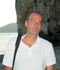
Daniele Casalbore is Researcher at the University Sapienza of Rome, where he teaches in the academic courses of Marine Geology, Marine Geophysics and Littoral dynamics. He earned in 2009 a PhD in Earth Sciences at the University Alma Mater of Bologna, and then worked 6 years at the CNR-IGAG as Post-Doc researcher. The research activity is mainly addressed to the study of submarine instability processes and their consequences, with particular reference to the flanks of active insular volcanoes and tectonically-controlled margins. Most of these studies are based on the processing and interpretation of high-resolution morpho-bathymetric data, especially through the comparison of repeated multibeam surveys to monitor the morphological evolution of the seafloor in geologically-active areas. In the last years, he has also studied the evolution and dispersion of flash-flood generated hyperpycnal flows into the sea as well as submarine indicators of past sea-levels and vertical deformations. He is author/co-author of 41 publications on ISI journals and tens of talks at national and international congresses; moreover, he was guest editor of a special issue on “Quaternary coastal and marine studies in Central Mediterranean".
Dr. Giacomo Deiana, University of Cagliari, Italy
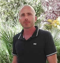
Giacomo Deiana has been Postdoctoral Researcher since 2009 at the Department of Chemical and Geological Sciences at the Cagliari University. He graduated in Geological Sciences (cum laude) at the University of Cagliari in 2005 and earned his PhD in Earth Sciences in 2009. He mainly deals with Marine Geomorphology and has participated in numerous oceanographic cruise in the Italian and in the eastern Mediterranean seas. The research activity was carried out under various research projects (MAGIC, RITMARE, MARINE STRATEGY, etc.) and mainly concerns the sismo-stratigraphic and bati-morphological characterization of the Italian continental margins by methods of geophysical marine exploration, including side scan sonar, multibeam and high-resolution single-channel seismic, ROV and seabed sampling. His main interests are related to submarine gravitational instability processes and the continental shelf habitat mapping and marine geomorphological cartography.
In 2015 he held the course "Physical Geography and Cartography" at the Faculty of Biology and Pharmacy - Natural Sciences degree.
He is co-author of 12 publications on international and national journals.
Dr. Sara Innangi, IAMC Naples, CNR, Italy
Sara Innangi is Researcher to IAMC Naples, CNR. She has excellent knowledge of light geophysical instruments (multibeam, sidescan sonar and chirp) for morpho-bathymetric survey, both technically and scientifically, for the realization of geologic hazard thematic cartography. She is expert of acquisition both in shallow water with very high resolution and in open sea. She is specialized in geophysical data processing, especially in elaboration of sidescan sonar and multibeam backscatter data and in geophysical data storage using Geographic Information System for cartographic restitutions.
Dr. Agostino Meo, University of Sannio, Italy
Agostino Meo , graduating with honors in Geological Sciences (2010) and Ph.D. in Earth and Life Sciences (2014).Since the beginning of his studies, he is involved in Marine Geology and Marine Geophysics. He has participated in several Oceanographic Surveys in the Mediterranean. His research concern: Acquisition and interpretation of multibeam data, with particular interest in morphometric analyses related to the Reach of active canyons; he also deals with: the study of erosive and depositional processes, geological risk related to tsunamigenic sources in the Mediterranean, geological map of Ionian Sea, depositional systems, submarine landslides and submarine canyons in the Eastern Mediterranean. He has worked on the MaGIC project (Marine Geohazards along the Italian Coasts, www.magicproject.it), contributing in the production of Sheets N° 42 - Metaponto and N° 43 - Taranto. He was also involved in the Ritmare project and several regional projects. He worked at the ICM - CSIC in Barcelona, studying and analyzing Montera landslide, in the Alboran Sea, Western Mediterranean.
ABSTRACT
Multibeam surveys are nowadays the fastest developing field in marine geology as they reveal with unpreceded detail seafloor feature highlighting sedimentary, biogenic, volcanic, tectonic and mass-wasting processes. Multibeam system relies on a complex architecture of acoustic transducers, motion sensor, sound velocity probes, location of vessel or AUV/ROV vehicles. Its applications are continuously developing, from repetitive surveys for monitoring seafloor variations to the acquisition of backscatter data in the water column. Therefore, it is the technology that most relies on data treatment, either for processing and for developing new interpretative tools of seafloor and possibly oceanographic processes.


